
Let us now continue the Part 3 of the tutorial. In the previous tutorial we covered how to convert KML files to ArcGIS shape files using DNRgps software. Now we will import the newly created file to ArcGIS and prepare our final resource map.
1. Open the ArcGIS in the state where we had created a separate layer containing only the required VDC boundary and add the layer data containing points mapped in Google earth (ie shape file created at the end of tutorial 3)
 2. As the points located in Google earth are in WGS 1984 coordinate system we have to transform it to Everest 1930.
· Go to ArcToolBox -> Projection and Transformation -> Feature -> Project
 Set the parameters as follows and the Project window should look as shown in the picture below
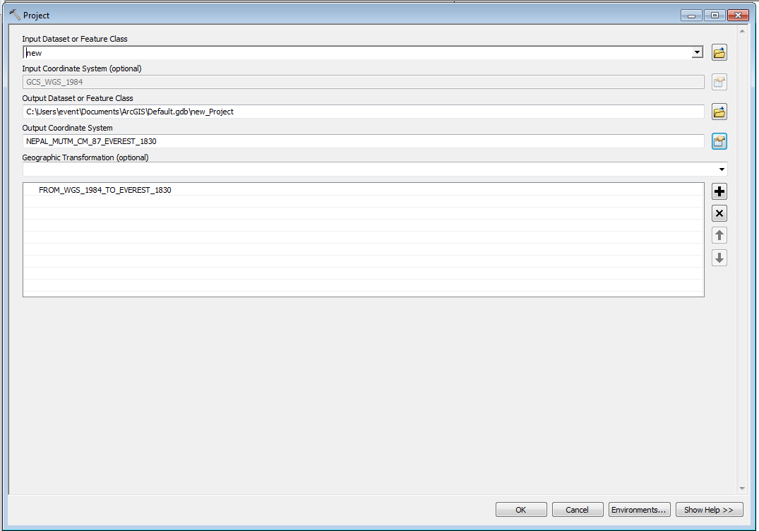 Click OK to get the transformed layer.
3. Now to label the points as mapped in Google earth follow the following steps
Right click the layer -> Properties

Go to labels tab and set the parameters as shown below. Note that the Label Field is ident as it contains name(identity) given by you whole plotting the points in Google earth
 Click OK.
4. Still the labels might not appear and if its the case again Right Click the layer and click Label Features
 5. Now after importing the pints you can overlay it with Landuse layer, Road network layer etc and prepare final map.
I have included the resource map that I have prepared for Sheshnarayan VDC of Kathmandu District which is now Dakshinkali Municipality ward no. 6 and 7.

1. Open the ArcGIS in the state where we had created a separate layer containing only the required VDC boundary and add the layer data containing points mapped in Google earth (ie shape file created at the end of tutorial 3)
· Go to ArcToolBox -> Projection and Transformation -> Feature -> Project
3. Now to label the points as mapped in Google earth follow the following steps
Right click the layer -> Properties
4. Still the labels might not appear and if its the case again Right Click the layer and click Label Features
I have included the resource map that I have prepared for Sheshnarayan VDC of Kathmandu District which is now Dakshinkali Municipality ward no. 6 and 7.
0 comments:
Post a Comment